/explorer
Miners & juniors
Where to drill next — and what it costs. Shorten the discovery cycle and turn the data you already paid for into your next drill program.
Enter as a minerFrom a fire-hose of evidence to one defensible decision
Your data. Today’s tech. Tomorrow’s targets.
AiRE is a mineral-exploration intelligence platform for miners, governments and investors. Give us the geological data you already own — satellite imagery, geophysics, geochemistry, drilling — and our expert-led council returns a ranked, evidence-traced drill-target list: every weight cited, every gap disclosed.
Submit your exploration data, receive a ranked target list in 48 hours.
Drill-proven. On a live East African nickel program, CAGE-IN-ranked targets were drill-tested and returned confirmed nickel mineralization — carried from raw archives to the rig. See the flagship case →
Who it’s for
Miners, national programs and investors come to AiRE with different questions. Each gets its own door — and its own straight answer.
/explorer
Where to drill next — and what it costs. Shorten the discovery cycle and turn the data you already paid for into your next drill program.
Enter as a miner/government
De-risk exploration at national scale — regional prospectivity mapping that draws investment into your critical and strategic minerals, with full data sovereignty.
Enter as a program/investor
Rank the assets in your portfolio on technical merit — which holdings are genuinely prospective, where the risk sits, and which would gain most from a CAGE-IN run.
Enter as an investorWhy explorers choose AiRE
Every AiRE result is built to be defended — to your board, your investors and your own geologists. Here is what that buys you that a generic AI tool cannot.
Most AI-prospectivity tools wrap an explanation around a black box. Here every score is traceable to a cited weight and a disclosed gap by construction — nothing to reverse-engineer.
The coverage disclosure shows exactly what your data could not see. You get the confident read and the honest limits, on the same page.
A seasoned explorer governs each project and signs off. The model shows its work; your geologist makes the call and takes it to the board.
NDA first, data rooms not email attachments, and credentials never live in our code or outputs — full data sovereignty for companies and governments alike.
How it works
Satellite imagery, geophysics, geochemistry, drill logs — in whatever state it exists. Legacy scans and messy archives included; that is where we start.
Your data is scored against 12 literature-calibrated deposit models. Every weight is cited, every coverage gap is disclosed, and an adversarial auditor tries to break each conclusion before it ships.
A ranked drill-target list with prospectivity maps, interactive 3D models and a full coverage disclosure — traceable evidence your geologist can sign.
Every engagement starts with the 48-hour Prospect Brief — a fixed-price, fixed-scope first look at your ground.
Outputs, not inputs
Credentials are inputs. These are outputs — sanitized examples of what lands on your desk at the end of an AiRE engagement. Project names, locations and client identifiers removed; the substance intact.
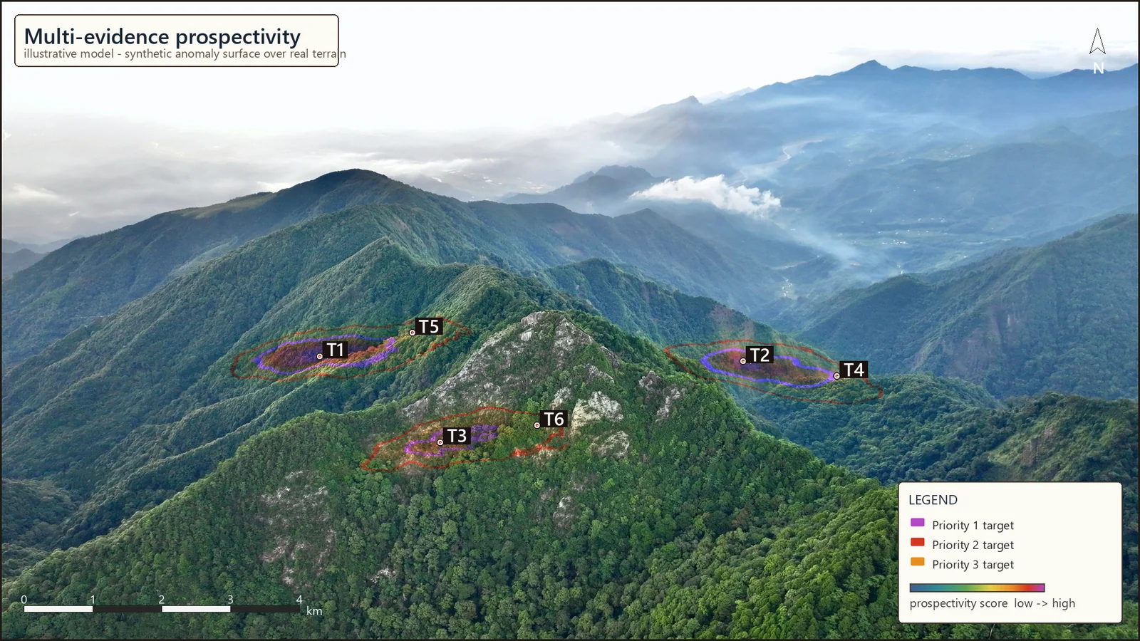
Multi-evidence score rasters with graded drill targets — every score traceable to the evidence layers, deposit model and literature behind it.
Greenfield nickel program · 308 ranked polygons from 13 evidence layersSingle-file 3D viewers your whole board can open — fly through the orebody, inspect every drill intercept. No software, no login, works offline.
3D large polymetallic deposit modelInstant interactive 3D viewer · no login · runs in your browser, even offline
Sanitized for confidentiality — nothing here is a disclosure of exploration results or mineral resources under NI 43-101 or the JORC Code, and no economic potential is implied.
Proof, not promises
On a live East African nickel program, CAGE-IN-ranked targets were drill-tested and returned confirmed nickel mineralization — carried from raw archives to the rig.
Blind tests prove recovery of what is already known; live programs are scored before anyone knows the answer — across nickel, copper-gold, iron ore and polymetallic ground.
NI 43-101 and JORC-aligned reporting is available, with a coverage disclosure that names every gap rather than papering over it.
Client references are available on request under NDA — we never publish client data or names without written consent. See the documented case studies →
Use cases
From grassroots ground to a producing mine, CAGE-IN solves a different problem at each stage of exploration — reconnaissance, targeting, optimisation, and resource expansion.
The AiRE Council
AiRE is led by a deep bench of senior exploration geologists and specialists spanning five continents. A named, qualified geologist — Dr. Tripathi — governs every project and signs every verdict. Working alongside that human team, a standing council of role-titled AI agents does the tireless work — stress-testing every target and citing every weight before anything ships. The model shows its work; your geologist makes the call.
Every parameter in every deposit model traces to published, peer-reviewed science. No exceptions, no folklore.
Nothing ships until the council's adversarial auditor has stress-tested every conclusion for false positives — and failed to break it.
The council keeps an append-only record of your geology, your data and every decision — across sessions and across years.
The builder’s story
Dr. Amit Tripathi spent three decades finding minerals the hard way — mapping, drilling and modeling across twenty countries on five continents. On every project he watched the same quiet failure: the science of ore deposits kept advancing, paper by paper, while the software interpreting exploration data stayed frozen at whatever the vendor shipped.
So he built what didn’t exist: a live, GPU-accelerated targeting platform whose deposit models are calibrated to peer-reviewed literature and updated as the science moves — guarded by more than 220 automated regression tests, and proven on live exploration programs.
“Every drill hole is a bet on an interpretation. I built CAGE-IN to make that bet the best-informed one on the table.”
Dr. Amit Tripathi · Founder, AiRE
The 80% reality
Most of the work in modern targeting is not the algorithm — it is the wrangling. Legacy MapInfo files, drill logs scanned to PDF, coordinate systems from 1994: that is where exploration programs lose their months, and it is where we start.
“Bring us your absolute worst folder.”
Mismatched datums, legacy geophysics, raw drill intercepts, unindexed geochemistry — the intake pipeline is built for the archive you actually have, not the database you wish you had.
Proprietary scripts ingest the structured majority — standardising datum projections, cleaning spatial coordinates and normalising assay detection limits across multi-year campaigns.
Months of spreadsheet alignment, eliminated.Specialised language-model pipelines read the “dark data” standard software ignores — scanned PDFs, unindexed drill logs, legacy structural reports — converting field notes into quantifiable spatial attributes.
Value recovered from forgotten paper archives.The safety catch. Every automated and language-model output is audited by an experienced exploration geologist before it reaches the targeting engine — checked at the rock level.
Human scrutiny before anything is scored.Geologist to geologist
Junior budgets are tight and drilling windows close fast. If you want to know whether your legacy geophysics, geochemistry or drill archives can support an AiRE run, skip the contact form and write to the founder directly.
PhD, Structural Geology · 30 years in the field
NDA first. Data rooms, not email attachments. Answered personally within two business days.
We don’t add to your data pile — we resolve it into a ranked drill decision you can sign and defend.