What We Offer
Our Services
End-to-end mineral exploration consulting — from reconnaissance to resource estimation, and everything in between.
AI-Driven Mineral Targeting with CAGE-IN Technology
Proprietary AI-based re-interpretation of your existing geological, geochemical and geophysical data to generate precision mineral targets — shortening the exploration cycle from years to months.
Learn more →
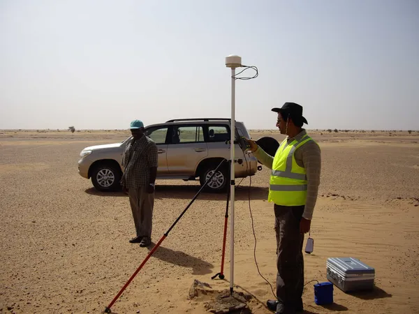
Mineral Reconnaissance
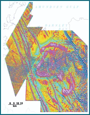
Remote sensing and field verification-based geological mapping of large areas to identify prospective targets for further investigation.
Learn more →
GIS Integration
Integrating data from multiple sources into a single unified database, enabling comprehensive spatial analysis across all exploration datasets.
Learn more →
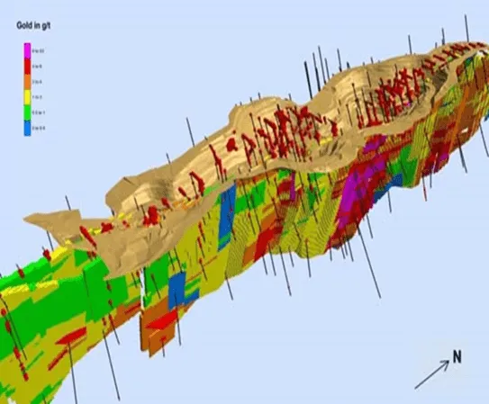
Turnkey Exploration & Resource Modelling
High-resolution mapping, sampling, and geophysics combined with predictive modelling and drill planning. Full drilling management including logging, sampling, QA-QC, cross sections, and resource models.
Learn more →
Exploration Technologies
Developing and deploying proprietary technology tools for efficient, AI-driven, and eco-friendly exploration — increasing process efficiency while reducing environmental impact.
Learn more →
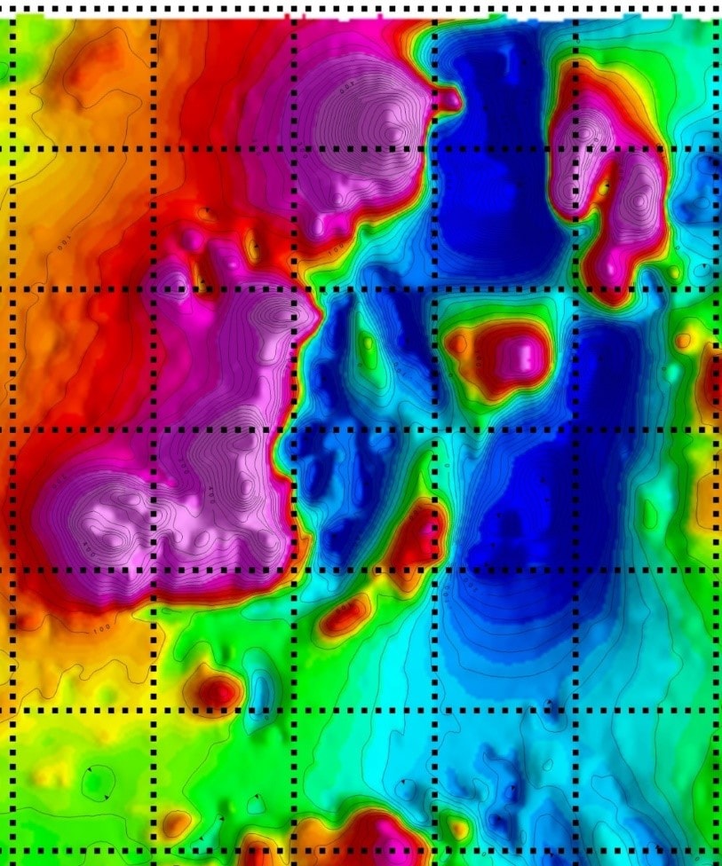
Integrated Data Interpretation
Proven proprietary technology for integrating historical data, known mineralization data, and geological and geophysical datasets for precise mineral targeting over large areas.
Learn more →
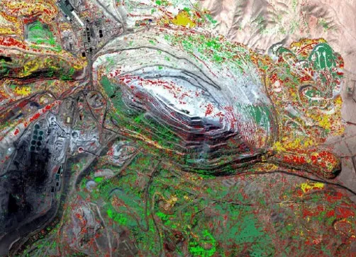
Mineral Intelligence
Remote sensing and drone-based surveys of mining areas for change detection of toxic pollutants, illegal mining activities, and production monitoring.
Learn more →
Mineral Policy Matters
Tracking policies and regulatory frameworks of countries that have successfully discovered and developed their mineral resources into productive mines.
Learn more →
Skill Development in Exploration
Capacity building of clients' in-house teams by embedding high-level geological expertise on site — accelerating team capabilities and exploration outcomes.
Learn more →
Mineral Reconnaissance
- Base mapping in Greenfield Exploration
- Lithology and structure mapping at local and regional scale
- Underground geological and structural mapping
- Geochemical anomaly mapping based on assay data
- Mapping alteration signatures relevant to the mineral of interest
- Analysis and interpretation of multiple datasets for target generation
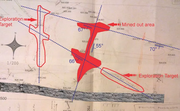
- Establishing structural controls of mineralization in 3D
Turnkey Exploration & Resource Modelling
- 3D modelling of major structures, fracture zones, lithologies, ore volumes, and alteration zones
- Converting the exploration drilling database into 3D models
- Mineralization target generation by litho-structure pattern study in 3D
- Modelling the distribution pattern of ore bodies
- Resource modelling using geological, geochemical and geophysical data
- 3D block modelling for resource estimation
GIS Integration
- Dedicated team highly experienced in satellite data interpretation — including high-resolution and hyper-spectral image interpretation
- Specialist capability in lithostructural interpretation combined with alteration and mineral mapping
- Large portfolio covering a wide range of commodities in diverse geological environments
- High-resolution imagery examination for geological mapping and mine planning
Integrated Data Interpretation
- Processing and interpretation of aeromagnetic and radiometric data to understand mineralization controls
- Integration of RS and geophysical datasets (2D and 3D) for target generation
- Prioritization of exploration targets
- Proprietary CAGE-IN technology for geological and geophysical data integration and enhanced interpretation
Skill Development in Exploration
We build the capacity of clients' in-house teams by embedding high-level geological expertise directly on site. As part of this service, we have developed custom data entry tools with:
- HTML-based tools using CSS / PHP / JS
- Dropdown lists defining permitted values to eliminate operator errors
- Validation rules updated as data is entered
- Operator access restricted to current working files
Work With Us
Discuss Your Project
Contact us to find out how our services can advance your exploration program.
Get in Touch